Home / Current Projects & Initiatives / Traffic Safety Action Plan
Through a grant awarded to the Town of Moncks Corner, we are working on a Safe Streets and Roads for All (SS4A) Safety Action Plan to eliminate traffic deaths and serious injuries.
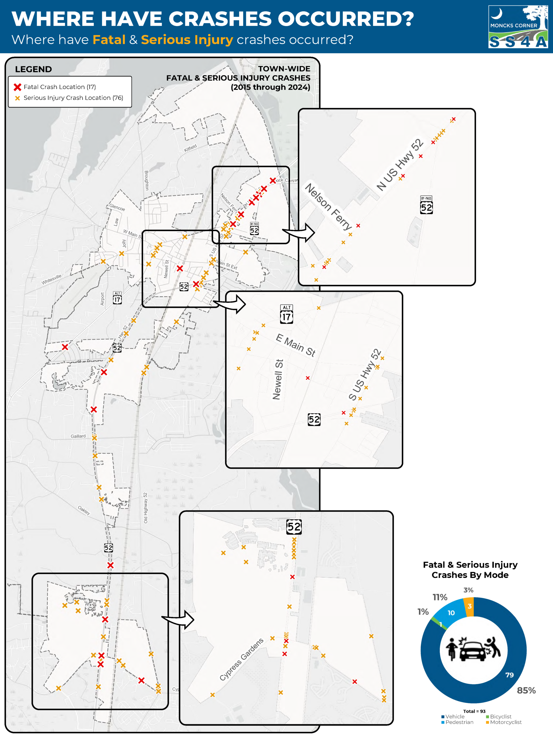
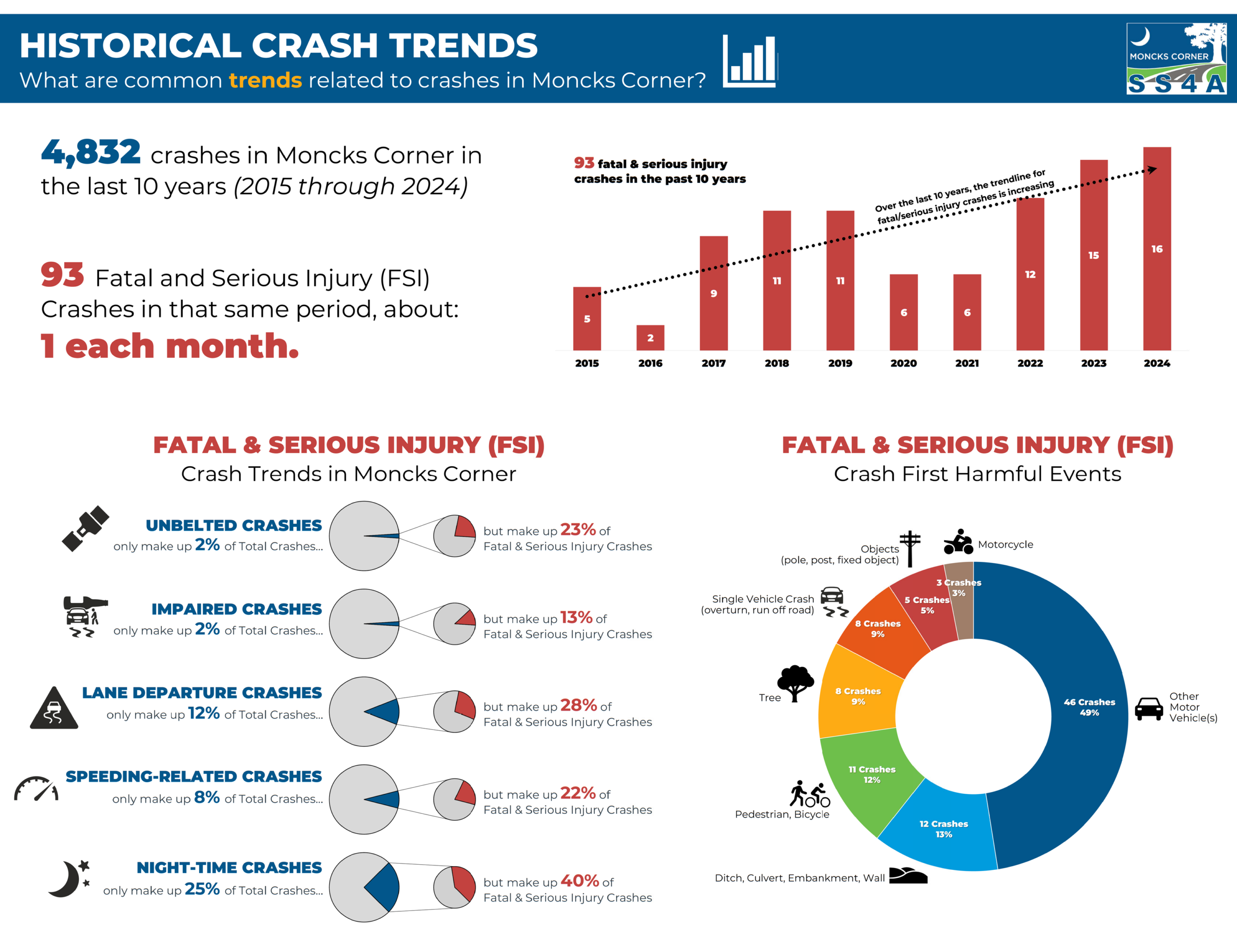
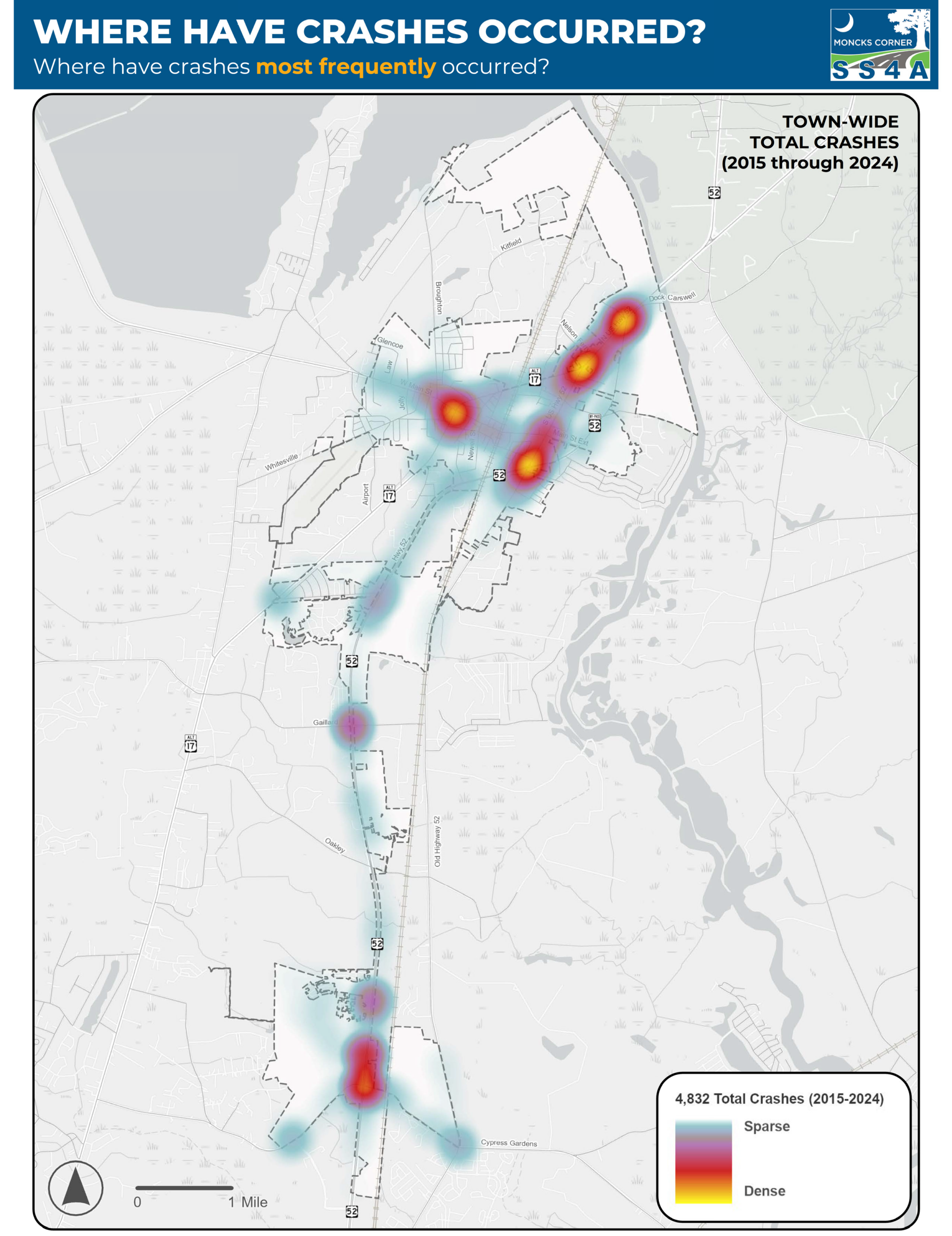
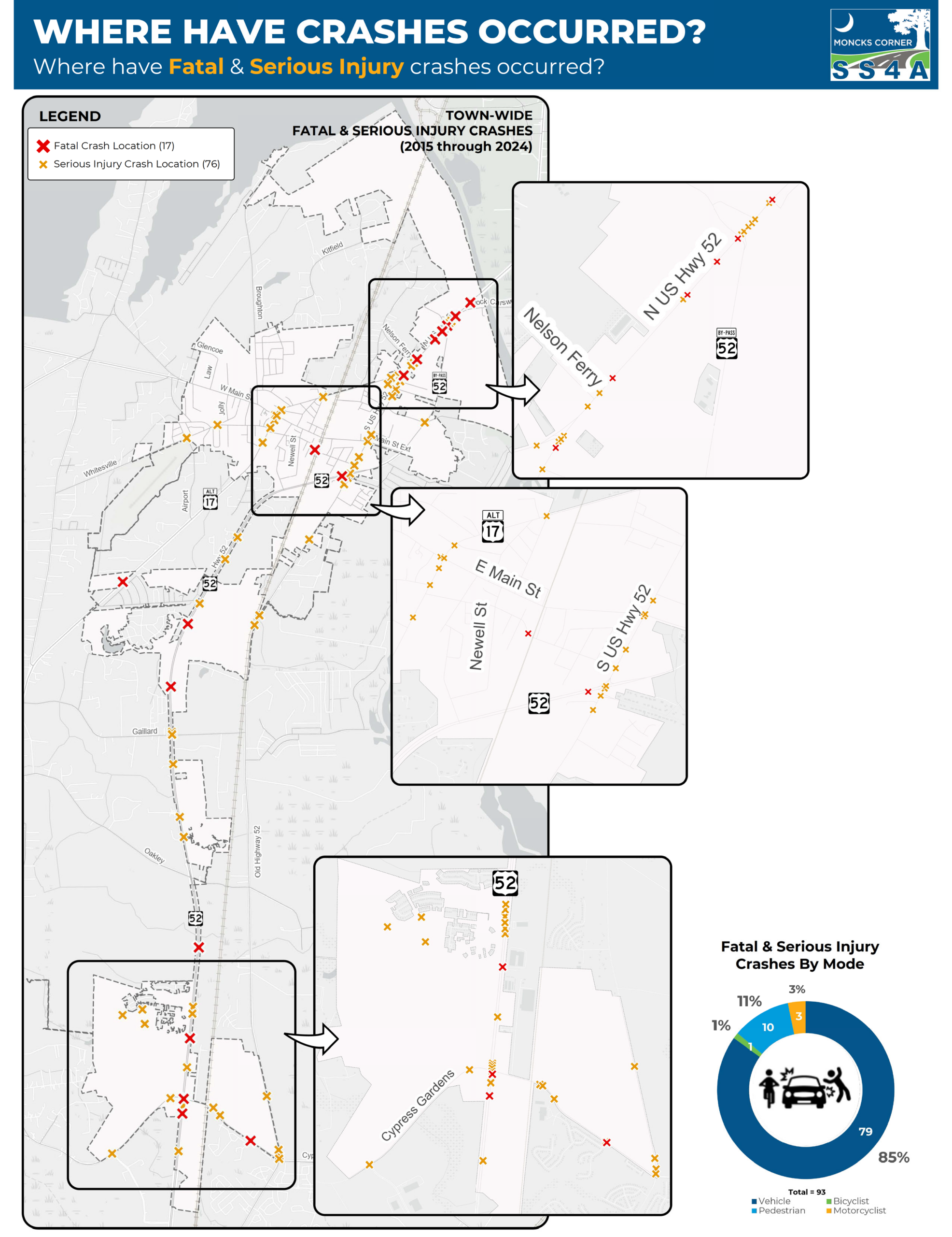
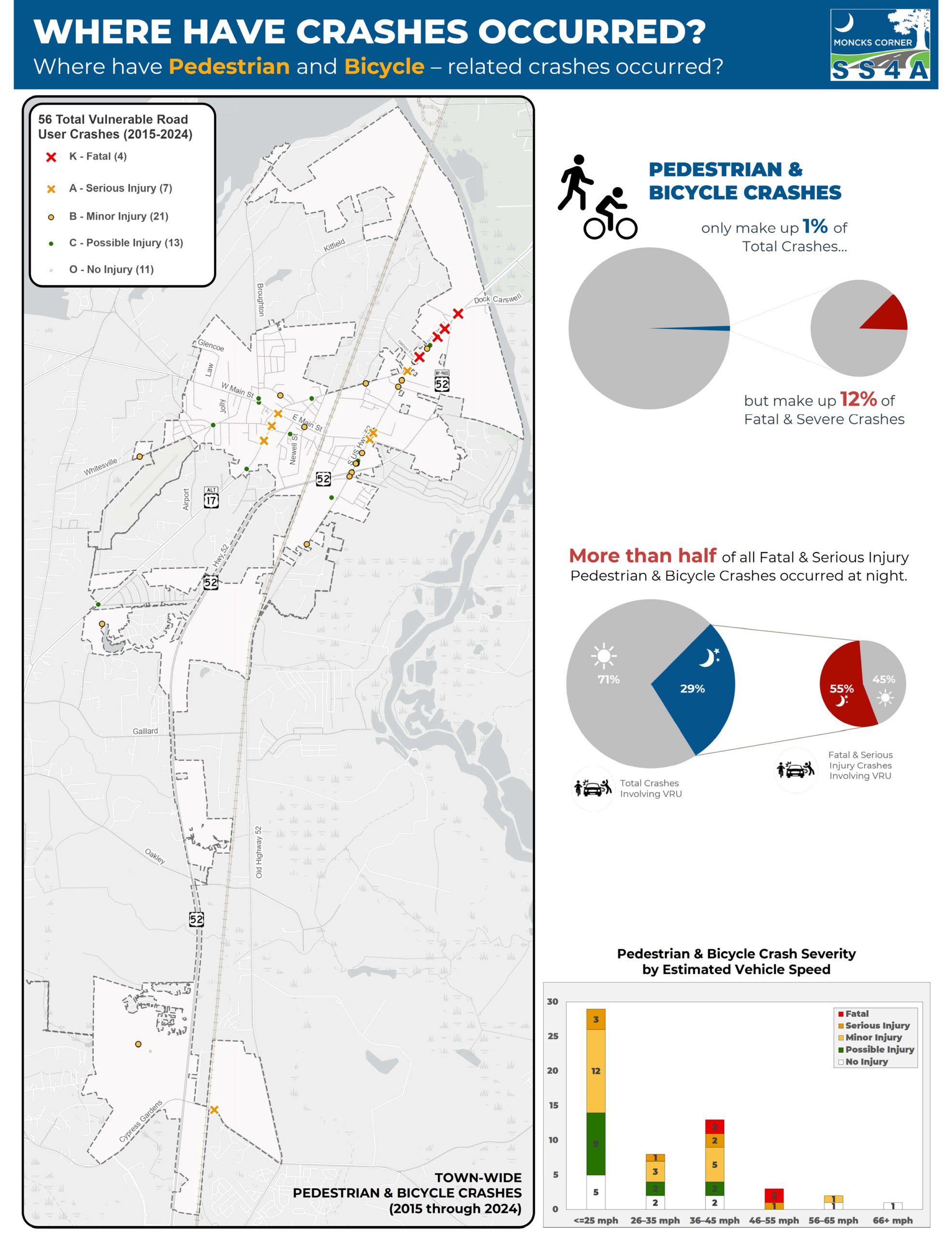
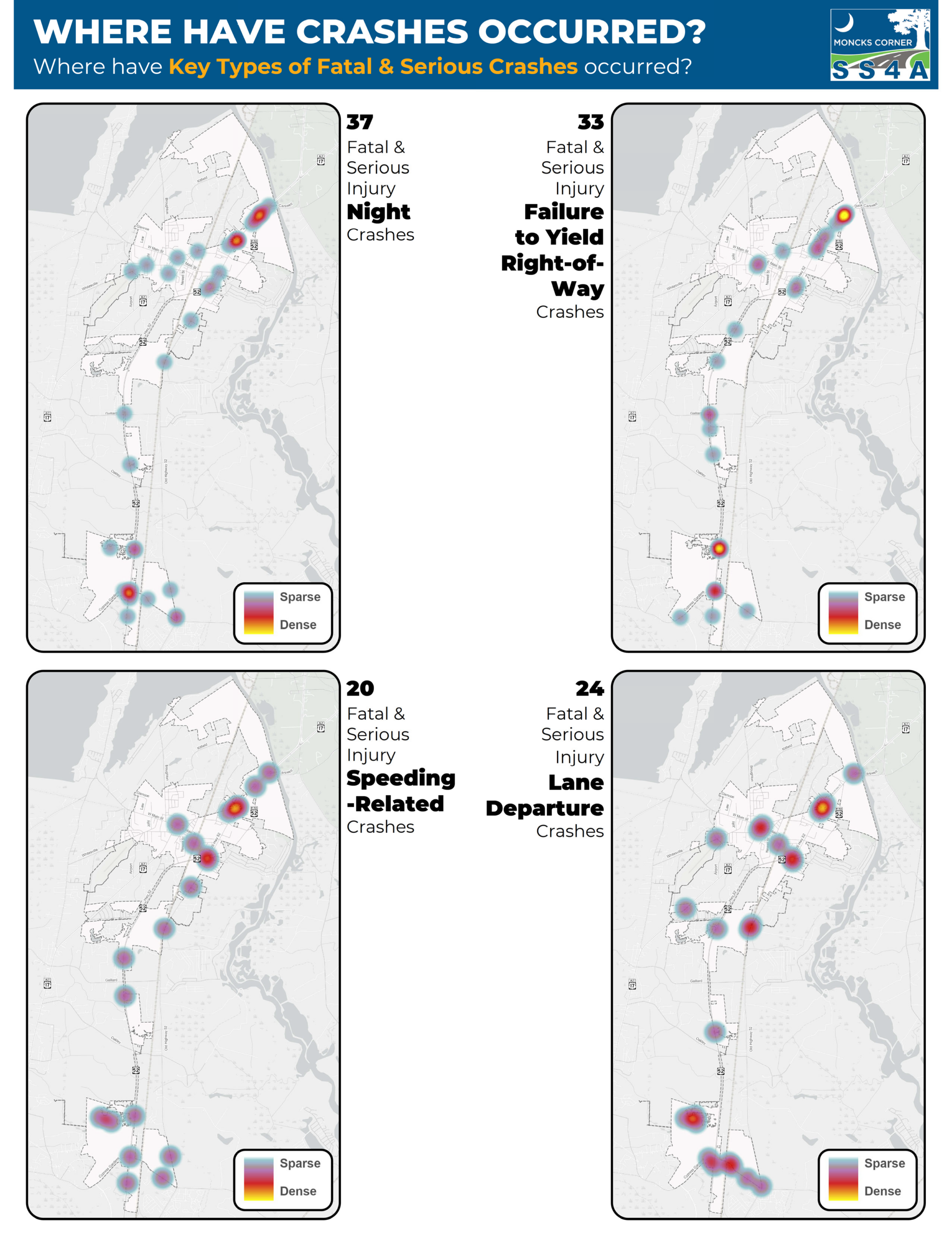
This Safety Action Plan will identify the most significant street safety concerns in the community and strategies to address safety issues aimed at eliminating serious injury and fatal crashes affecting all roadway users.
The Safety Action Plan is the first step toward implementing safety improvements with federal funding from the Safe Streets and Roads for All (SS4A) program, and your experiences matter. Whether you walk, bike, drive, or ride transit, we need your feedback.
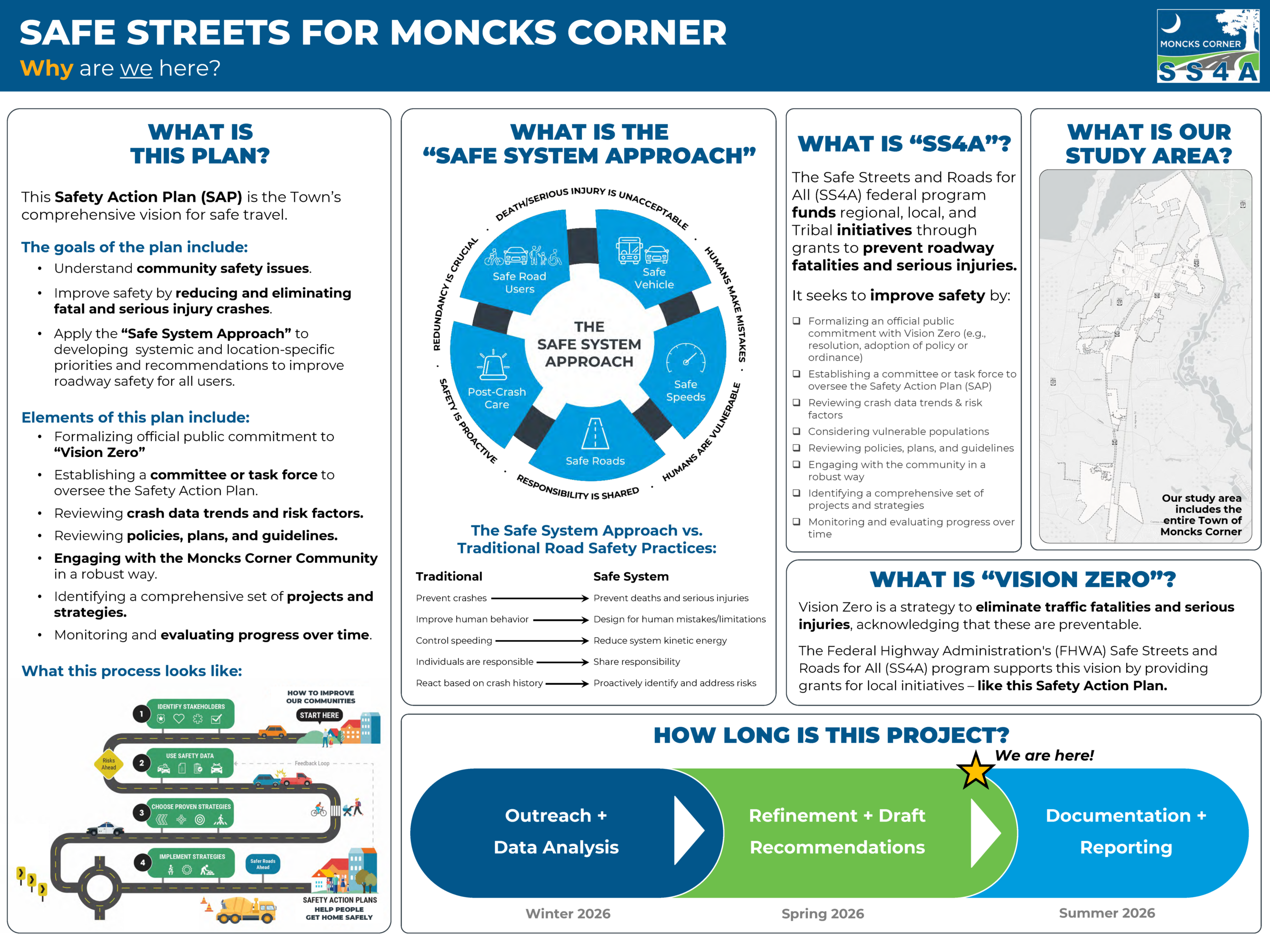
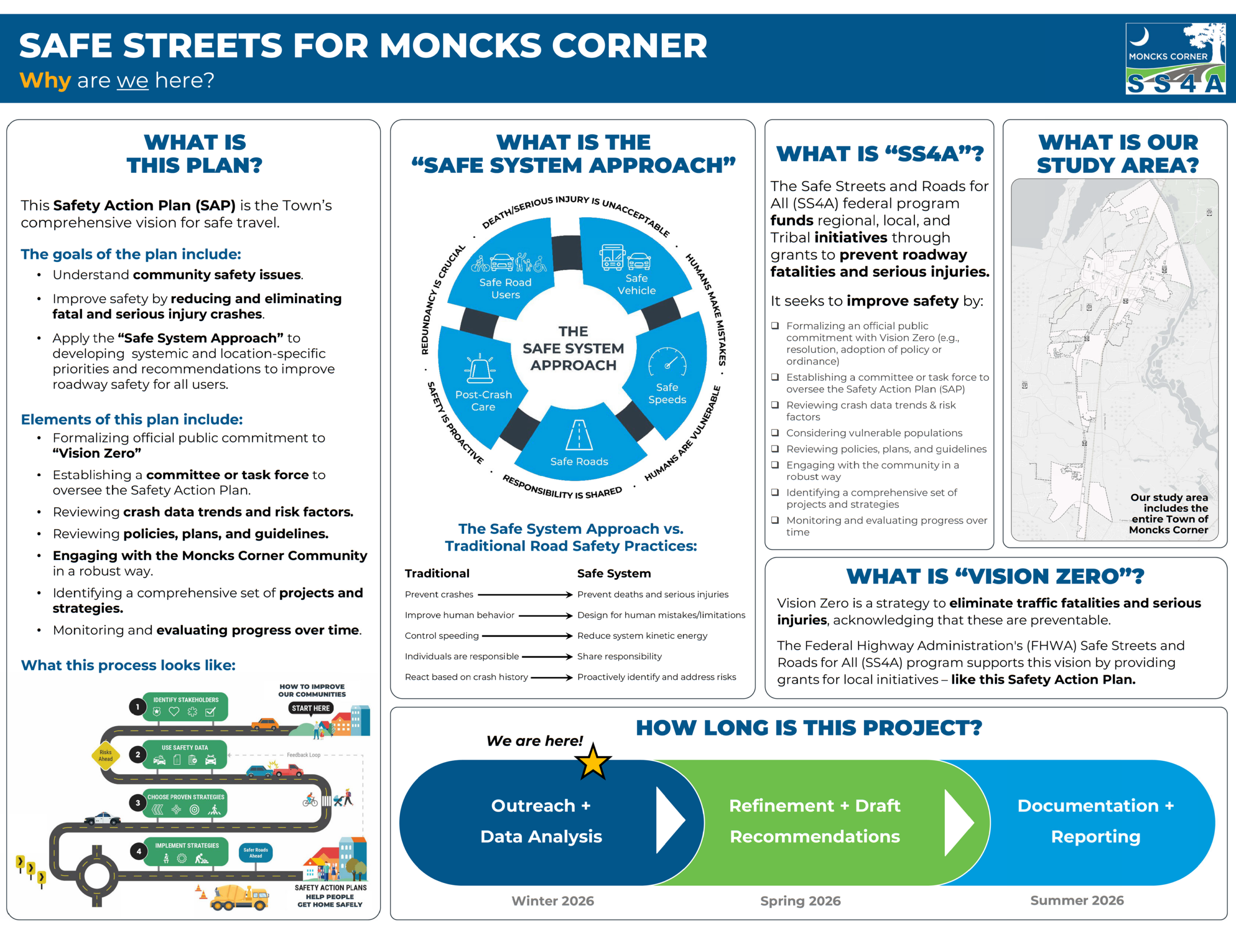
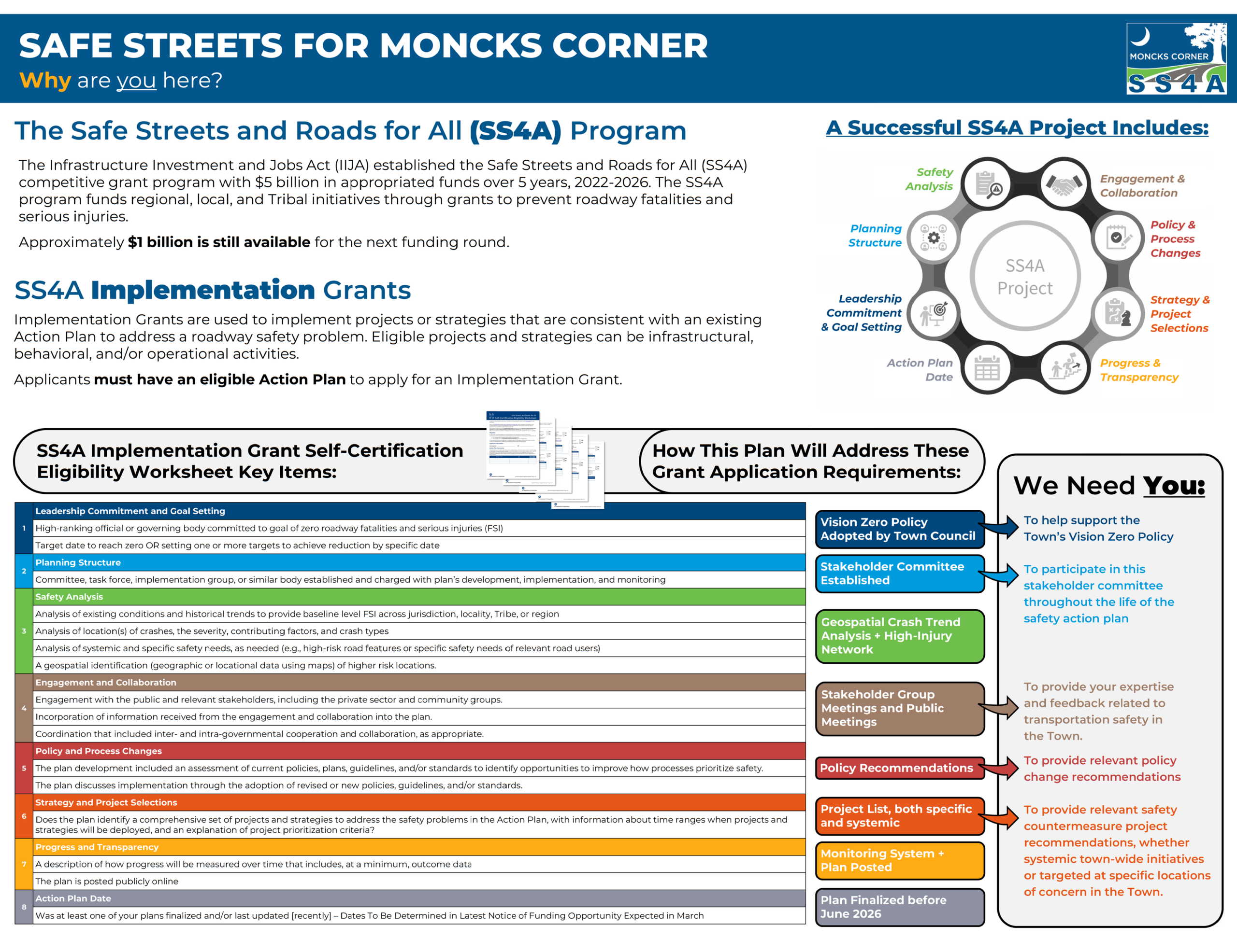
The Safety Action Plan (SAP) is Moncks Corner’s comprehensive vision to create a safe, accessible, and equitable experience for traveling in and around Moncks Corner. The goal of this plan is to prioritize and justify the investment of safety improvements that prevent injuries and save lives along our public roadways. The SAP’s development is supported by the Safe Streets and Roads for All (SS4A) initiative which is a grant program established by the Bipartisan Infrastructure Law (BIL). Once complete, this Safety Action Plan will allow Moncks Corner to apply for implementation grant funding to implement the plan through SS4A.
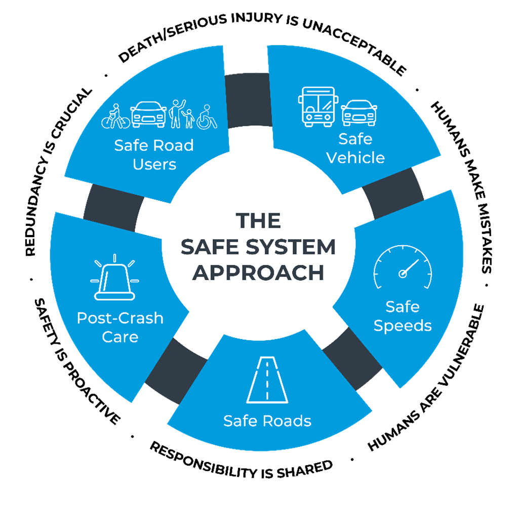
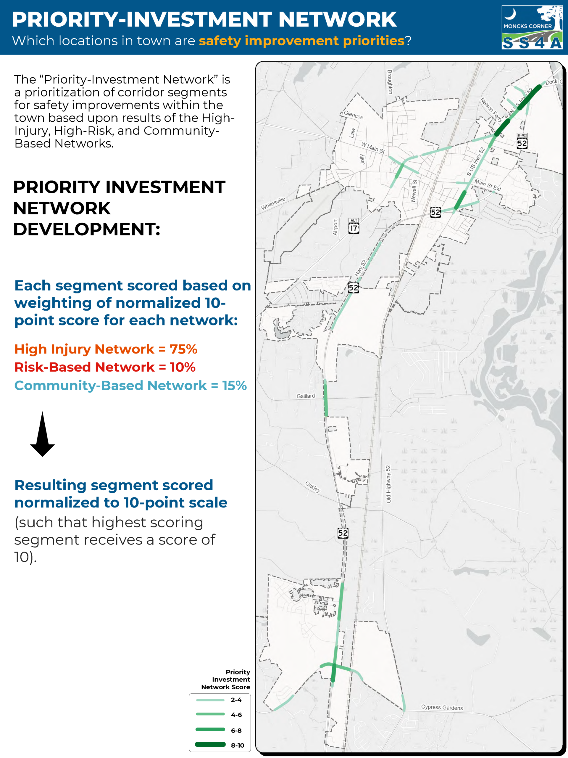
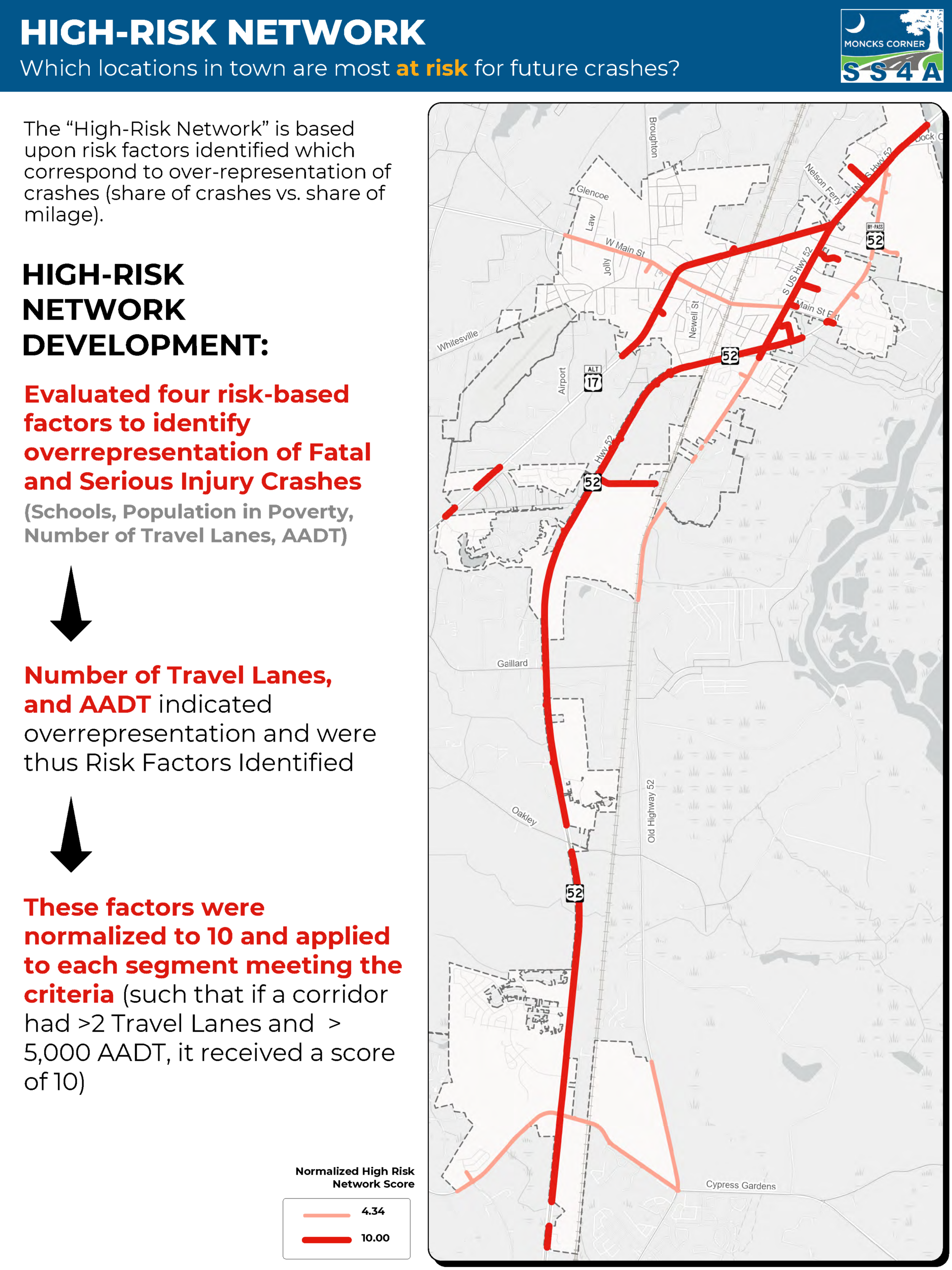
By using the Federal Highway Administration’s “Safe System Approach” to roadway safety to achieve Vision Zero – Zero deaths on our roadways, the Safety Action Plan (SAP) will identify the most significant roadway safety concerns in Moncks Corner and strategies to address safety issues aimed at reducing and eliminating serious injury and fatal crashes affecting all roadway users.
Together, these elements form the foundation of a proactive, data-driven approach to making Moncks Corner’s streets safer for everyone.
You are the everyday users of our streets in Moncks Corner. This project webpage connects YOU – Moncks Corner residents, business owners, and other community members – with the project team. We need your input and feedback for a successful plan that identifies necessary pedestrian, bicycle, and roadway projects that make your community safer!
After reviewing the documents below, tell us what you think! A solid plan is only as good as the feedback provided by the citizens. Please take a couple of minutes and let us know what you think so far. You can provide us guidance and feedback by filling out the survey here.
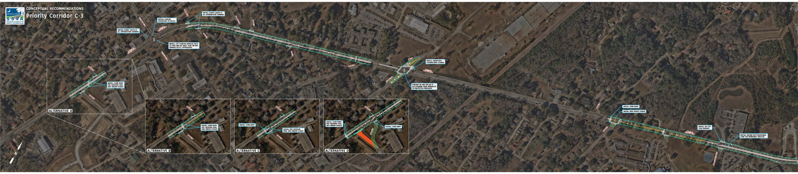
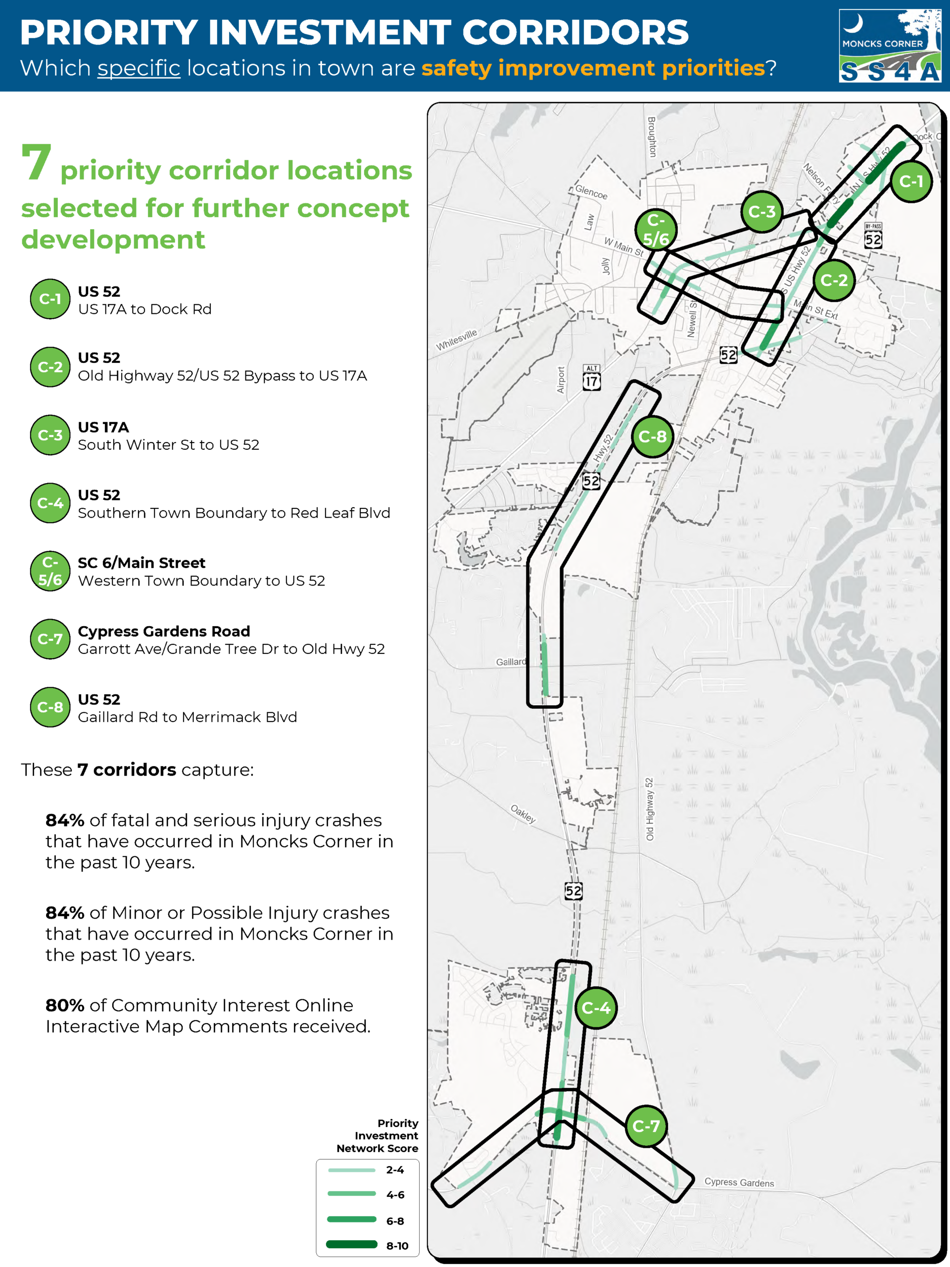
Between US-17A (N. Live Oak Drive) & Reid Hill Road/Rembert C. Dennis Blvd.
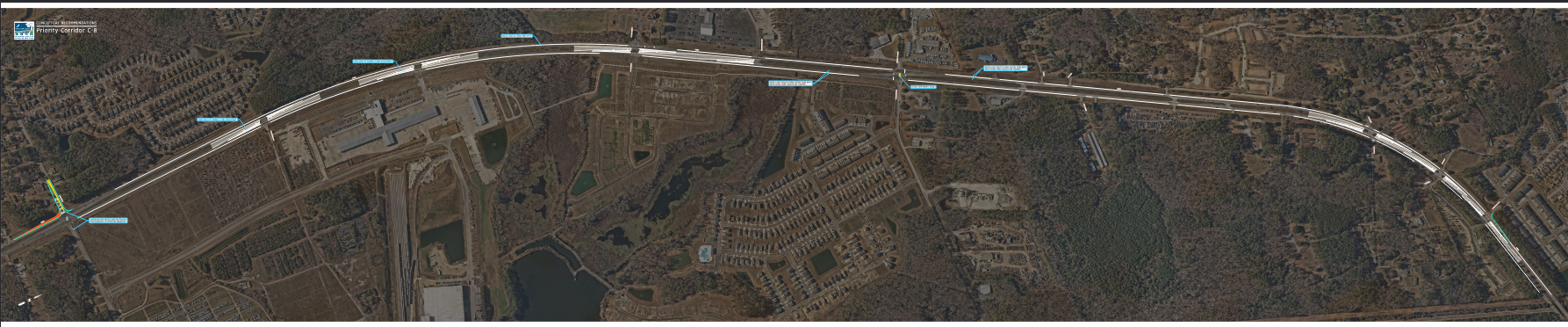
Between Old Highway 52/Rembert C. Dennis Blvd. & US-17A (Rembert C. Dennis Blvd.)
Between Main Street & US-52
US-52 & Red Leaf Blvd.
Between Stag Street & Gadsden Street
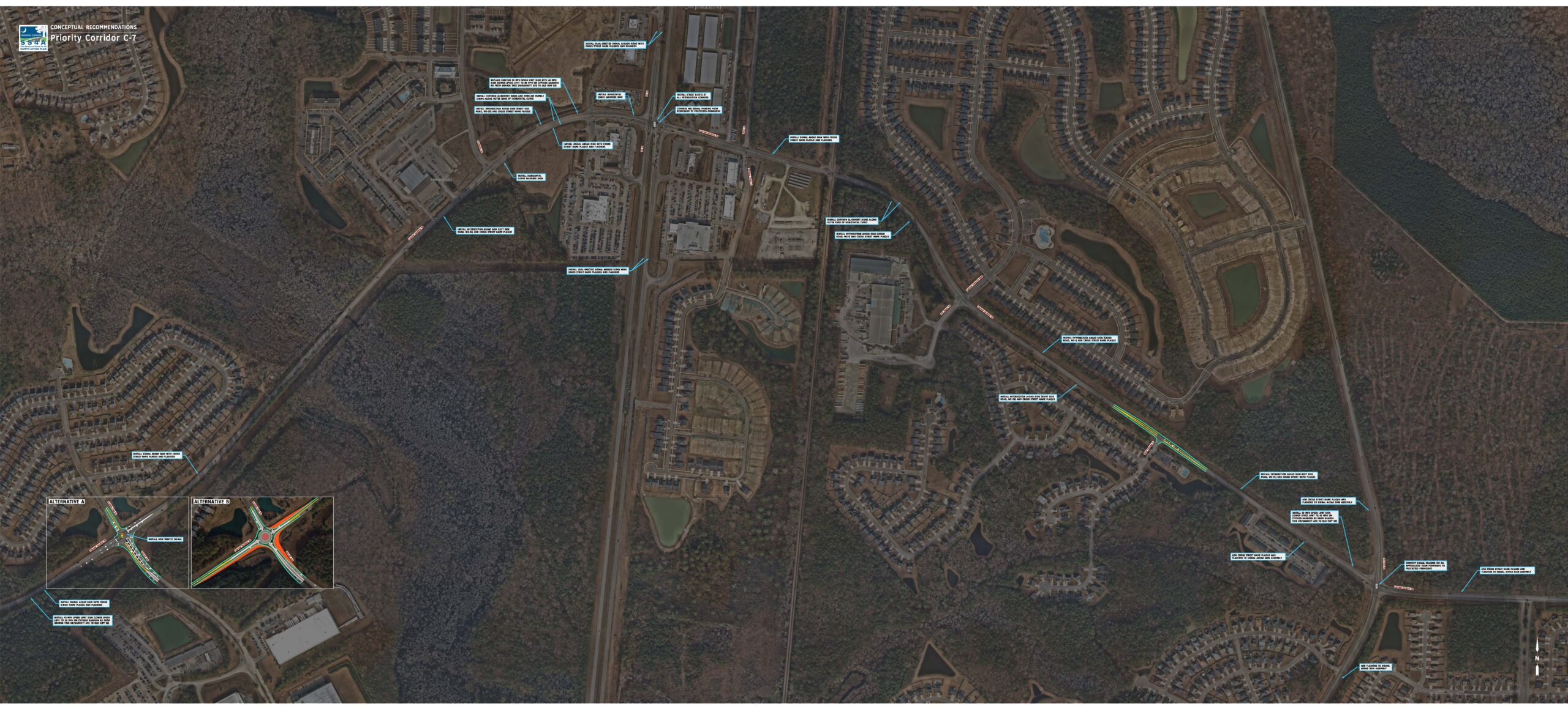
Between Grande Tree Drive/Garrott Avenue & Old Highway 52
US-52, between Gaillard Road & Old Merrimack Blvd.
Do you have questions, comments, or other insights to share with the project team?
Connect with the Project Manager, Justin Westbrook, at [email protected] or 843-719-7913
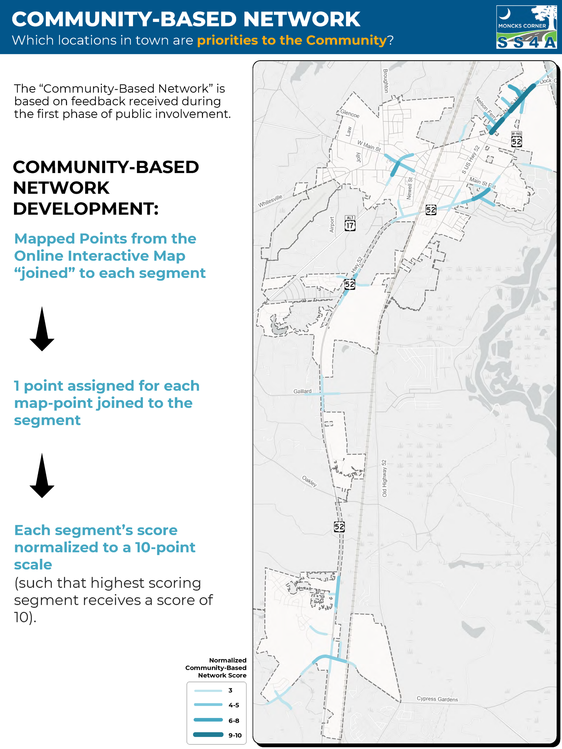
We want to hear from YOU about the issues, challenges, and opportunities you see as you travel around your community, whether you walk, bike, drive or ride in a car, or ride transit. Your knowledge is a valuable resource, and our online survey is critical to understanding what works and what doesn’t in the community. Our online survey should take less than 10 minutes to complete. Please also share this survey opportunity with your friends, family, and neighbors.